I have some experience working with JavaScript for various web mapping applications. Below is some of my experience with JavaScript.
COVID-19 Web Map
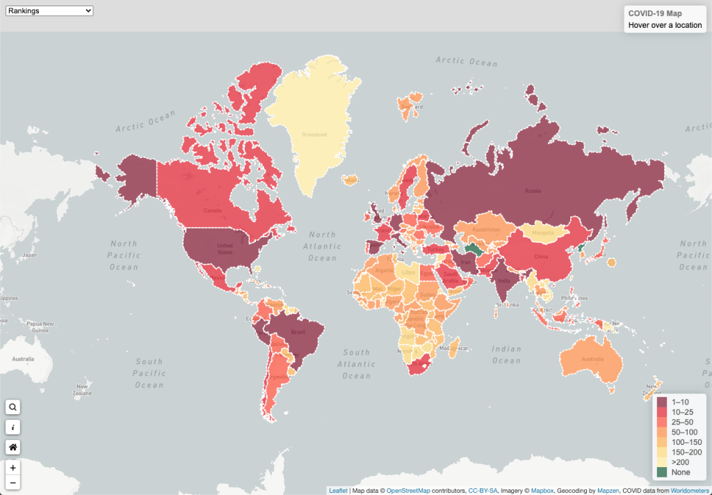
I made a web app that shows a live, up to date map for COVID-19 worldwide. The data is collected via a web scraper written in Python and then is pushed to a GeoJSON file. I then used JavaScript and Leaflet to read this GeoJSON data and display it as a choropleth map.
Click the image below to view the app. You can find the code on my Github.
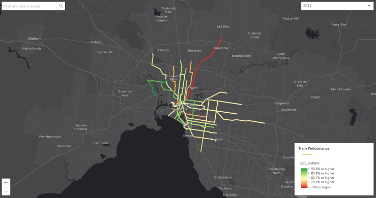
Yarra Trams Network Performance Map
I made a web app using ArcGIS’s JavaScript API that shows the performance of the tram network in Melbourne. Click the image below to view the app. You can find the source code here on Github.